mapping
Utility Mapping
Creates a simple, digital record underground utilities.
Digital utility sketches give you a clear, easy‑to‑reference view of where underground utilities were marked during our locate. They provide a simple, lasting record you can overlay on your site plans, helping you understand field conditions and keep your project moving smoothly.
What This Service Is
Understanding Utility Mapping
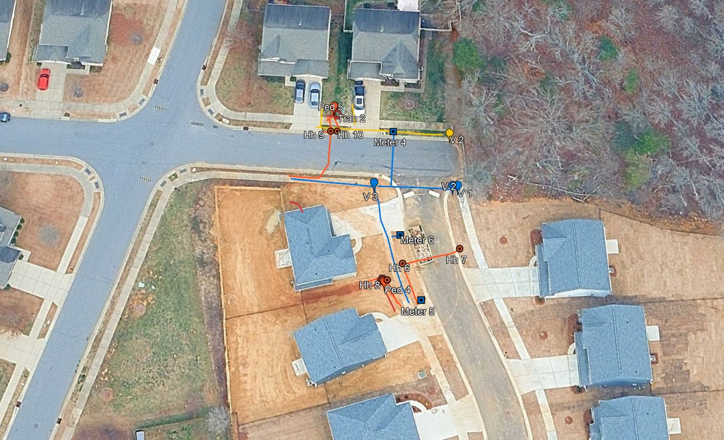
Digital sketches of utility locating marks capture our field designations and illustrate the approximate horizontal alignment of the utilities we identified. These sketches can be overlaid directly onto your existing plans, giving project teams a clear visual reference for where utilities were marked during our investigation.
By documenting field conditions beyond temporary paint or flags, digital sketches improve coordination, support SUE quality‑level reporting, reduce the need for repeat locates, and help engineers identify potential conflicts earlier in the design process. The result is more informed decision‑making, fewer surprises in the field, and stronger protection of underground infrastructure throughout the project lifecycle.
Note: These sketches are provided for reference only and are not a substitute for a survey performed by a licensed surveyor.
Why It Matters
The Importance of Utility Mapping
Utility mapping gives you a better understanding of what’s underground before work begins. It helps prevent costly surprises, keeps projects moving smoothly, and provides reliable documentation you can reference long after temporary paint or flags are gone.
Helps you understand what’s underground before work begins
Reduces costly surprises and project delays
Provides a digital record that lasts longer than paint or flags
Improves communication and coordination across your team
Supports safer digging and protects underground utilities
What You Get
Deliverables & Outcomes
How We Work
Our Process
Assessment
We evaluate field conditions and determine the best approach for marking the underground utilities found on site.
Field Work
We locate and mark underground utilities, capturing the information needed for mapping.
Utility Mapping
We use our utility mapping equipment to input all underground utilities that we marked in the field to create the digital deliverable.
Documentation
You receive clear, overlay ready digital utility sketches that show the approximate horizontal alignment of located utilities.